Well, Bavi really is a super tyhoon, just like Sinlaku. Here’s the thing – when the forecasters predicted a super typhoon that would hit the Philippines after leaving a trail of damage in the Marianas – we paid more attention. And when we pay attention – things have a way of easing out.
With all our heaviest hitters focused on quake prevention and mitigation – a virtual handicap for a year, we are fortunate to have a “deep bench” so to speak.
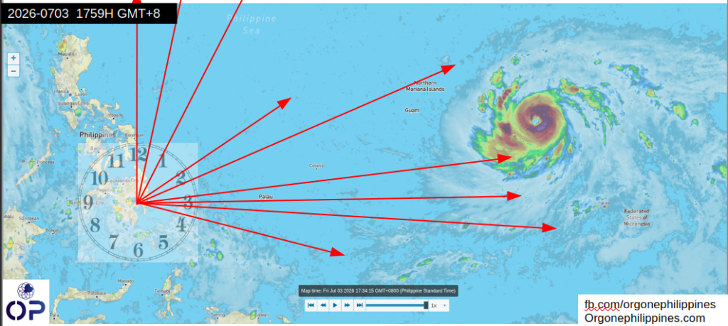
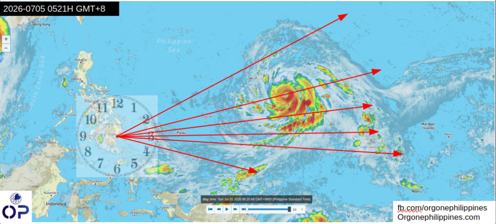
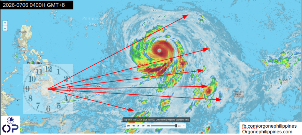
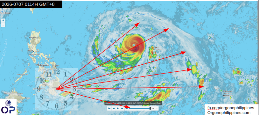
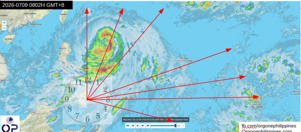
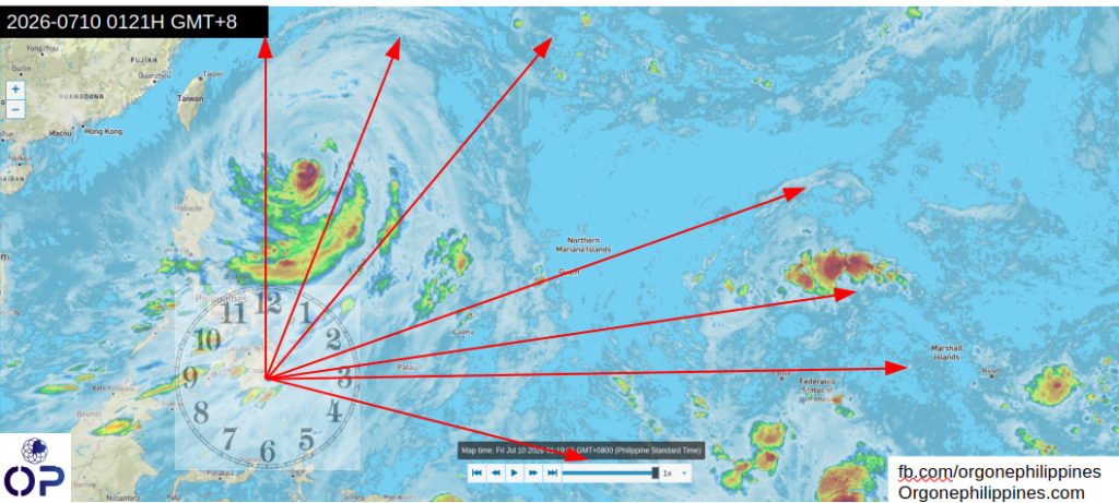
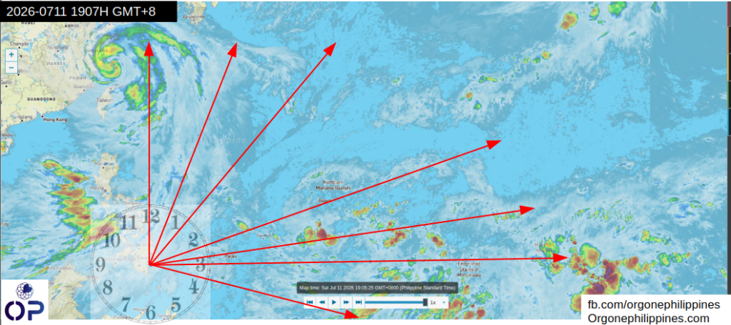
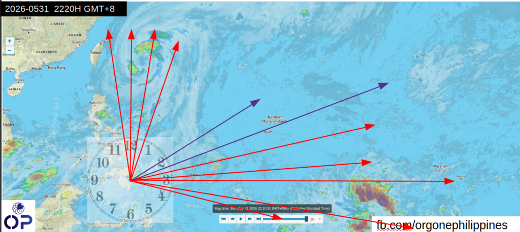
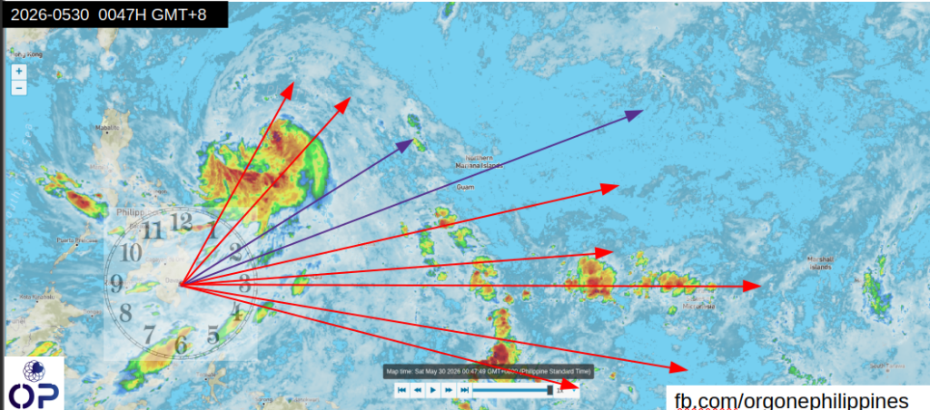
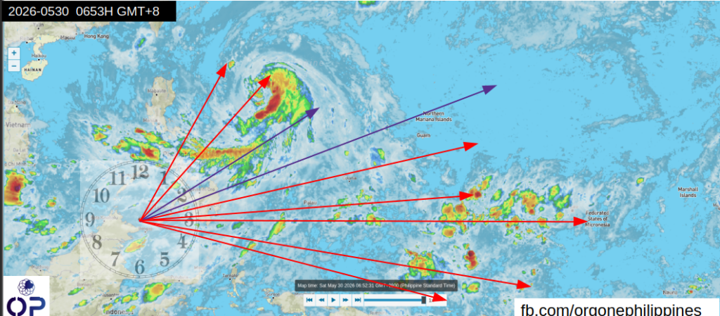
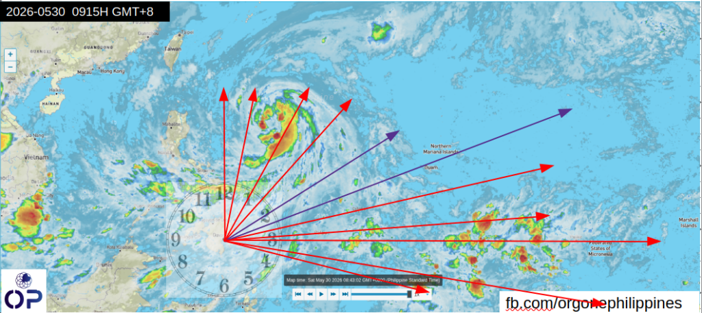
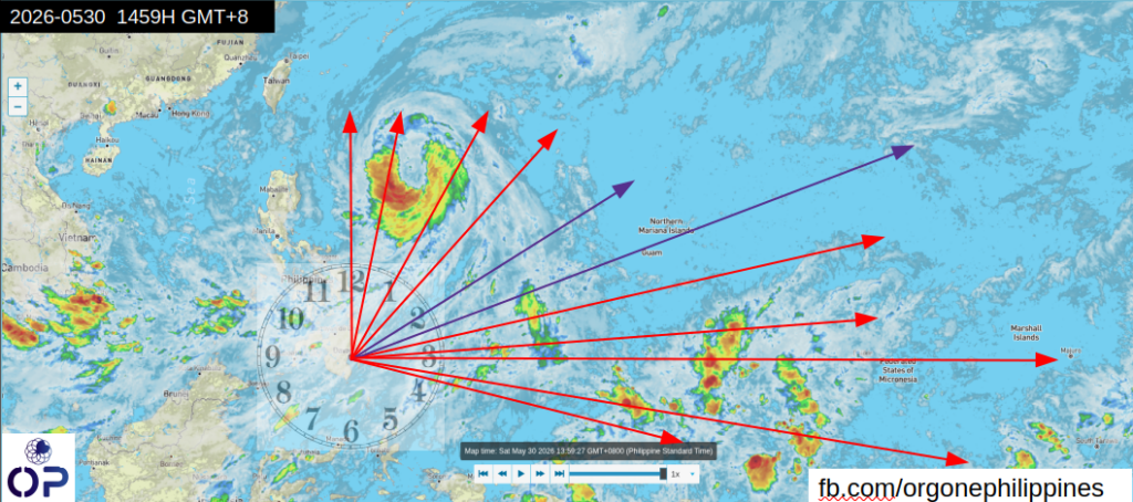
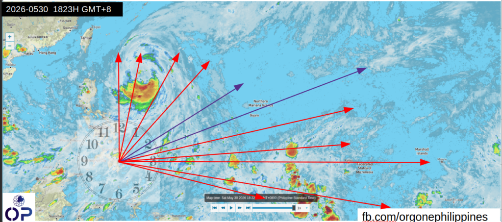
Here’s the timeline of Bavi’s approach to the Philippines, where the supertyphoon became a typhoon.
July 3, 2026
July 5, 2026
July 6, 2026
July 7, 2026
July 9, 2026
July 10, 2026
July 11, 2026
At this point, we cut Bavi loose and prepare for the next round.
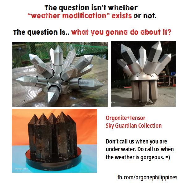
After years of Orgonite R & D starting in 2018, along the coastline of Davao City in what used to be the fishing village of Talomo, I am releasing the Weather Defense Guide for those who own pyramids, towers, and classic Sky Guardians made by us.
Let’s go.
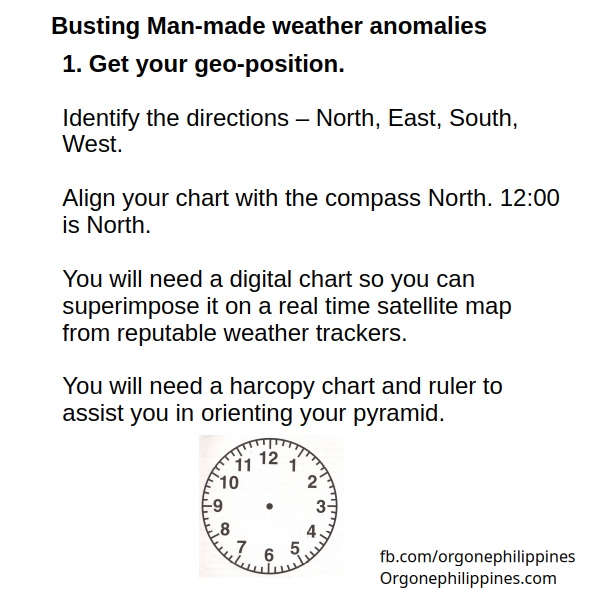
Just click on the thumbnail to get the full resolution image.
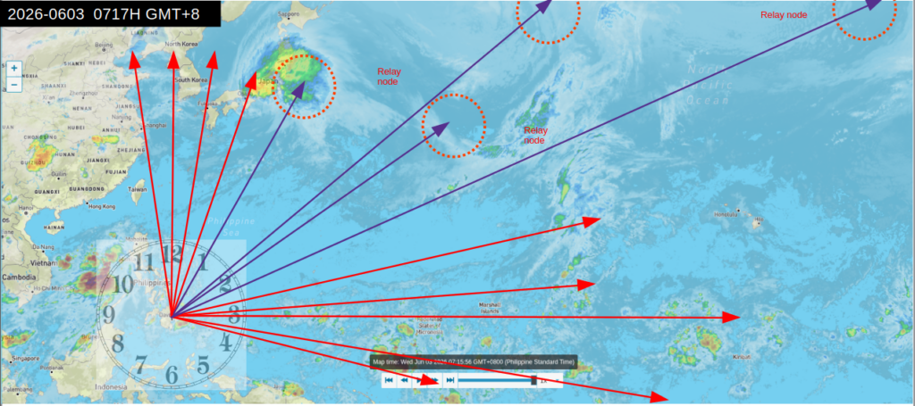
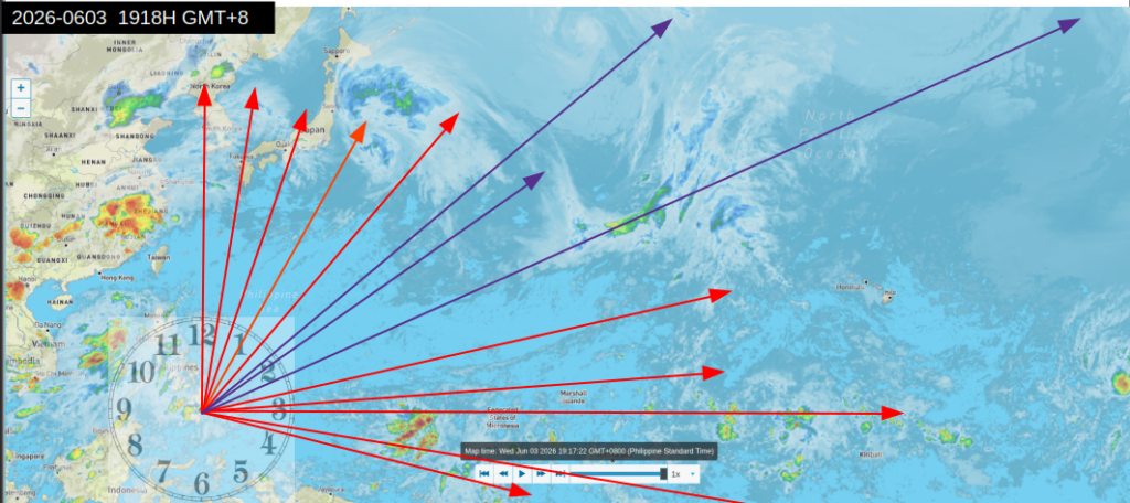
For this morning’s snapshot 2026-0603 0717H GMT+8.
Jangmi’ is no longer threat to Taiwan at this point. Luzon is getting it’s share of rain – you asked for it, you got it. The weather in Davao City is beginning to feel like the 1970s – sunshine during daytime, showers at night, and really chilly mornings.
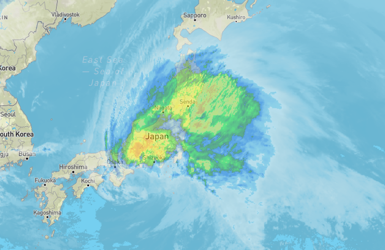
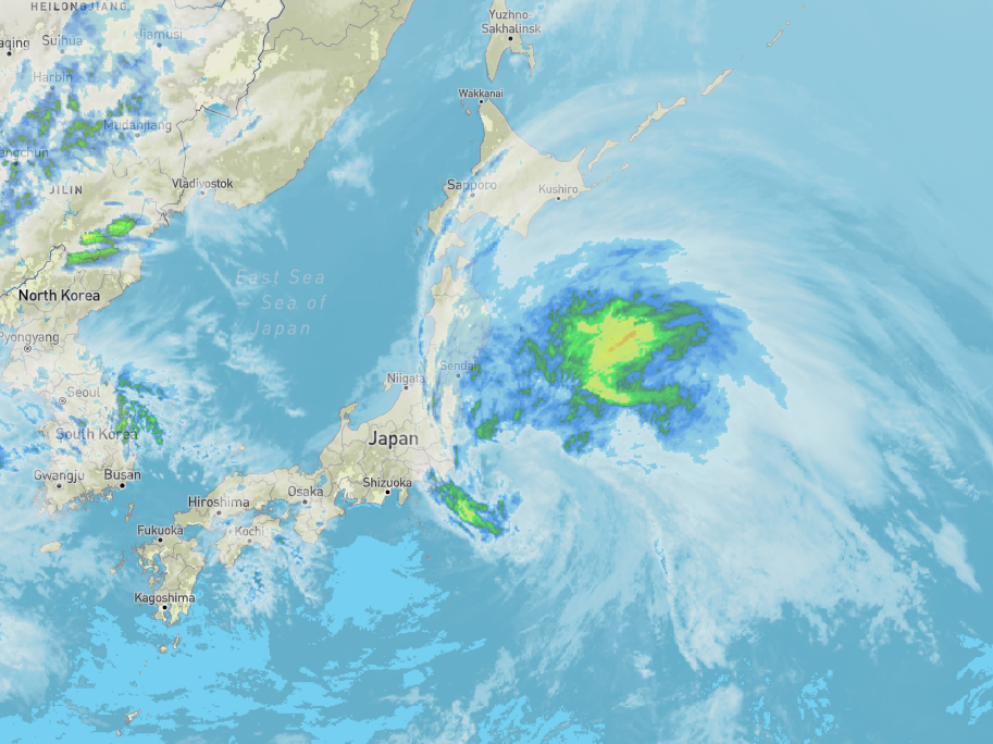
A closer look shows Southern Japan is clearing up – and not-a-typhoon Jangmi is moving towards Tokyo. There were casualties too – but not massive. Still, one life lost is too much.
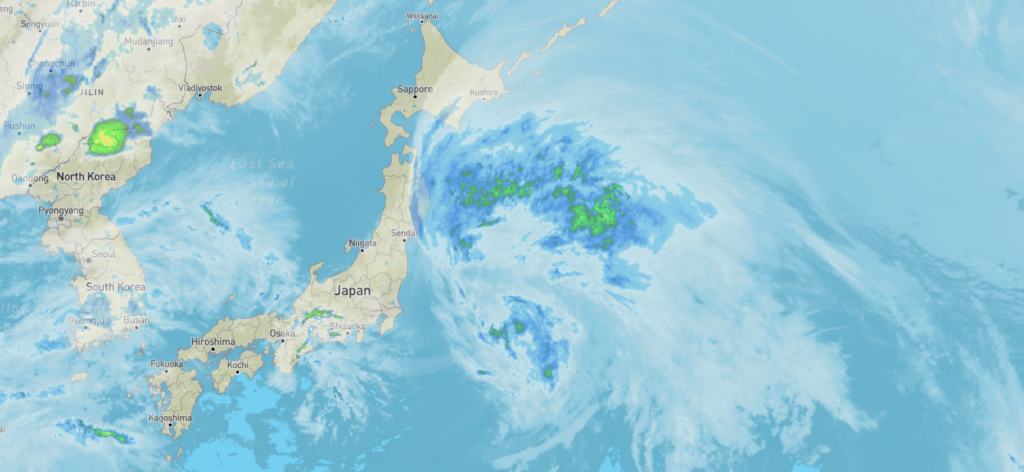
.Time to adjust the bearings as Jangmi moves towards Tokyo.
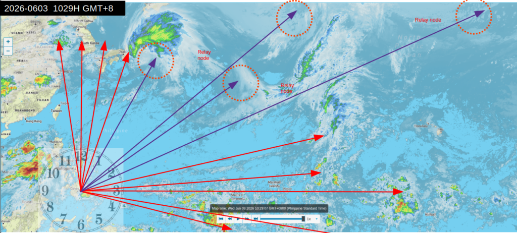
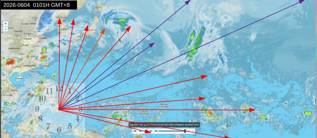
Time to check the situation 060326 1029H GMT+8
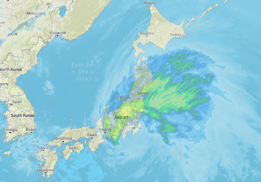
We then zoom into Japan.
Note that the yellow and green bands has been reduced – basically fraying apart.
I will continue to observe till noontime.
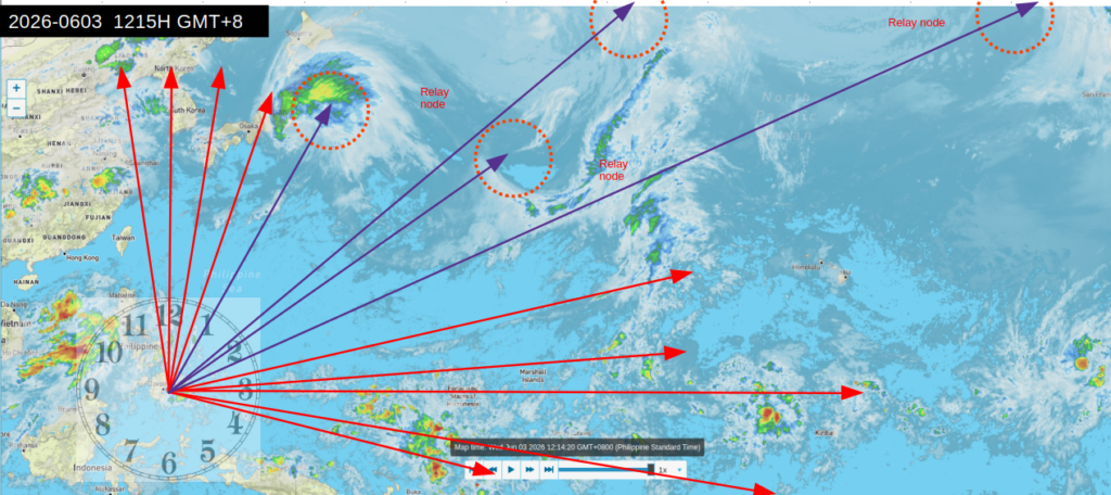
Noontime update 060326 1215H GMT+8
Mid afternoon update 060326 1533H GMT+8
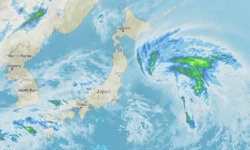
The center of gravity has shifted. Southern Japan has already eased up. We will now shift the direction cover the area from 1:30 to 2:30.
Note the fraying edges of the storm. The center or the “eye” is in yellow, roughly 1:00 in our “line of sight”.
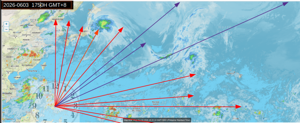
Update 060326 1750H GMT+8
Jangmi is certainly easing up on Japan. We aren’t out of the woods, yet. If we remove the devices – it can easily regrow and cause more widespread havoc.
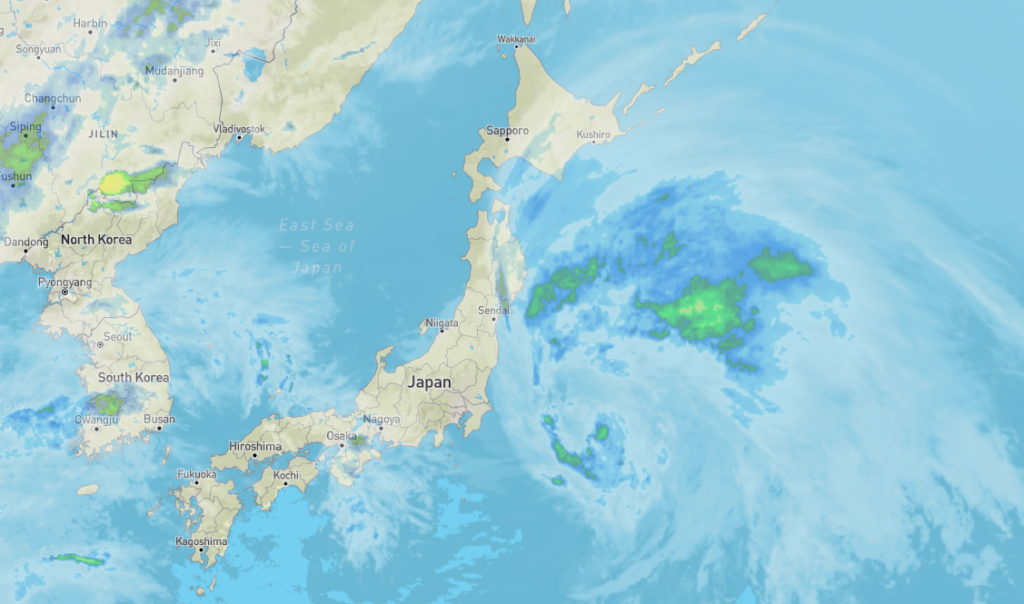
It’s going to be a rather quick moving system at this point.
Nothing crazy is happening. but riding along the southshore of Japan with really heavy rain, but we’ll get that continued weakening trend.
You can watch the forecast here. 👇
Jun 2, 2026 – Area to Watch! In this video, the chance of Tropical Development near the Philippines and Taiwan. The chance a Tropical Depression or Tropical Storm could form. Plus, the Tropical Storm impacts from Jangmi in parts of Japan
We can’t be complacent because Jangmi is on a weakening trend. I’d say it’s time to go for the kill shot . 😎
Time to adjust the direction of my heavy hitters located in this section of our site, pointed north towards Jangmi over Japan (roughly between 1 click after 12:00 to 1:00) – 5 classic sky guardians (think Gatling Gun), 1 mini sky guardian , and 5 pyramids,
Pointed to the east (3:00) are 3 pyramids – keep the moisture buildup caused by ionospheric heaters in Central America at bay.
With the adjustments made, we wait and see. Get ready for the next snapshot.
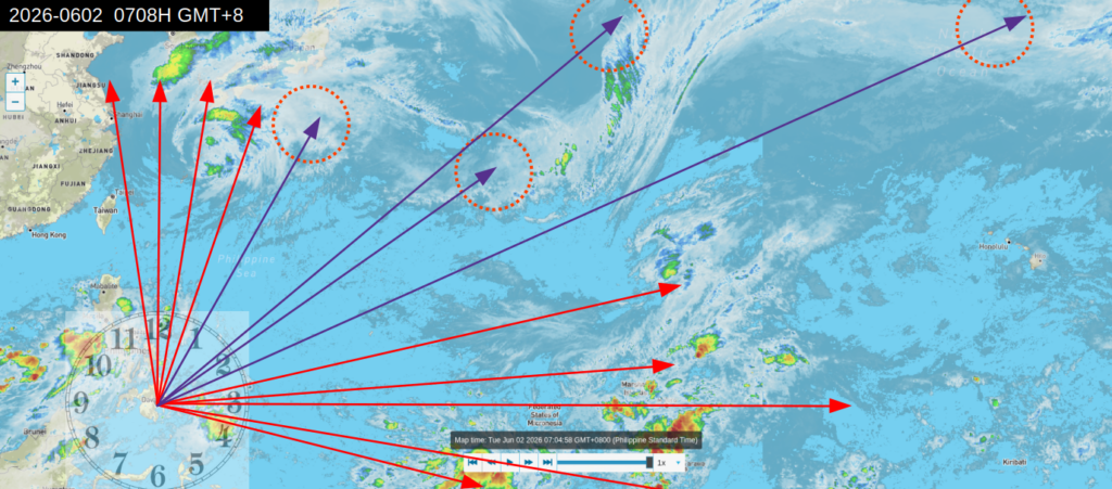
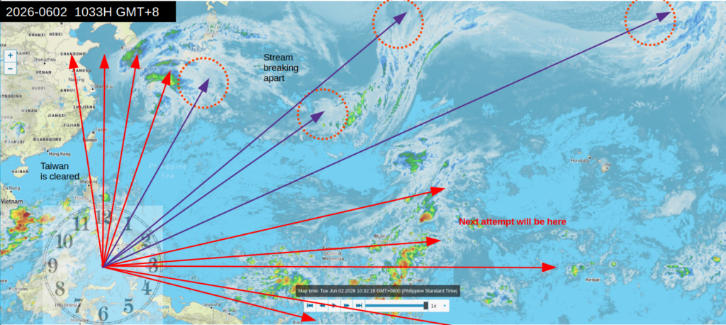
Snapshot as of mid-morning 060226 1033H GMT+8
The threat to Taiwan has been greatly reduced. My dear ones on vacation in Taiwan will have great weather. 🥰
Now for Japan, the supply line of moisture is beginning to break, particularly the stream in between the first two encircled nodes on the left.
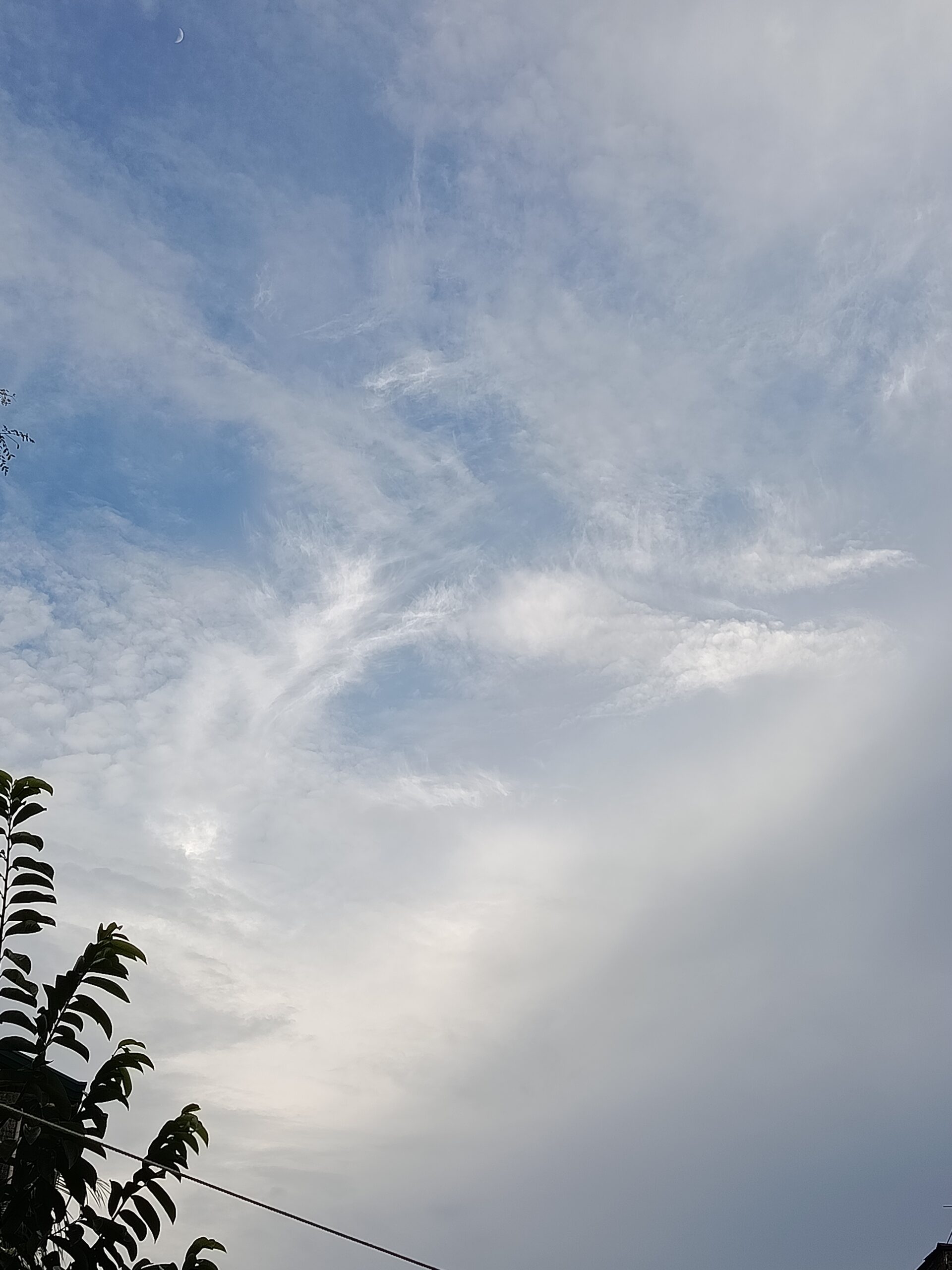
The ionospheric heaters are working overtime because they really want Taiwan to take a hit. How did I come to that conclusion? Well, the vacationers complained about the extreme heat. Second, I received a video of Taiwan’s sky – and the cloud patterns bore the signature of ionospheric heaters.👇
Another storm formation attempt is in the making at the Marshall Islands.
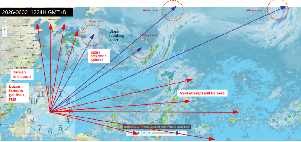
And for the noontime snapshot 060226 1224H
Farmers in Northern Luzon got their rain. Taiwan remains unscathe. Japan gets heavy rains instead of a typhoon.
I can now redirect the pieces used for Taiwan – and direct them towards Japan. I will still leave behind a rear guard for Taiwan.
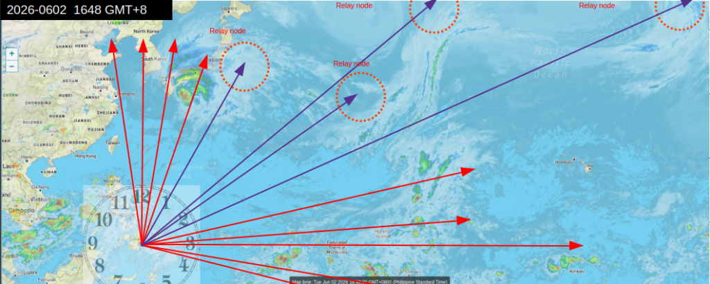
And for the afternoon snapshot, 060226 1648H GMT+8..
060226 1854H GMT+8
I noted the green bands over Southern Japan. Given that the devices are inclined to 45°, this means overshooting the target (Southern Japan)because the system is in a higher altitude. I have changed the incline to around 60°.
Here’s the thing, I can hear the energy (clairaudience ?) – and when it hits the target, from a steady buzz – it transforms to a swarm of cicadas, feels like human sonar. 👽
Adjustments have been made – we now sit back and wait till the next snapshot.
The Philippines avoided a weather catastrophe named Jangmi – just as the Philippnes avoided Sinlaku.
How could that have happened – avoiding two cyclones in a row ??? 😁 wink wink
Weather predicters and forecasters scrambled and came up with… drum rolls please… Super El Nino, 😂
The extreme heat in Northern Luzon had farmers clamoring for rain. If I may qualify, rain that does not cause flood, landslides, and damages to lives and property – and it was given.
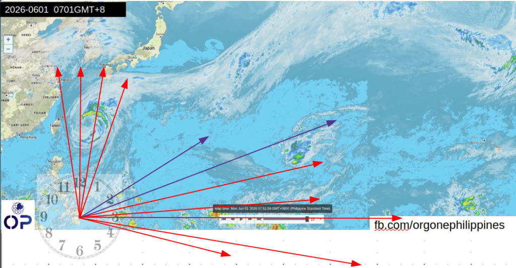
Here’s the weather snapshot of 060126 0701H GMT+8.
I noticed something interesting though. When I zoomed out to view a wider geographical area, I observed a pattern, a flow of moisture coming from Alaska, delivered in a relay of vortices to Jangmi.
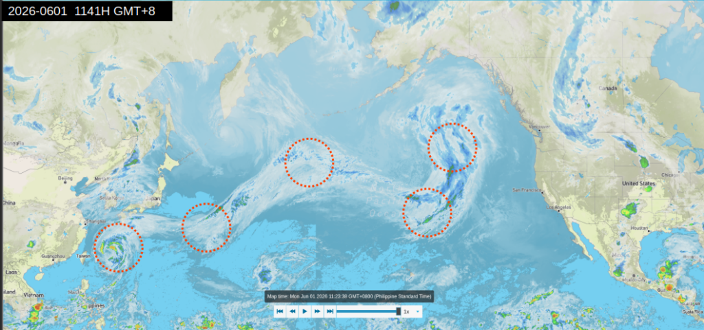
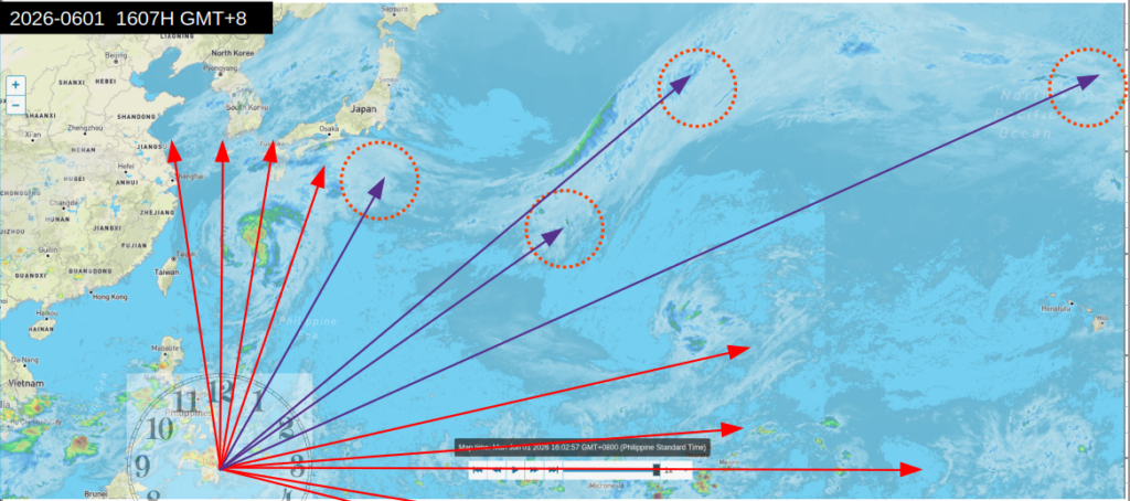
The relay nodes which I encirgled appear to be cogs of one huge conveyor belt of moisture. With that hunch in mind, I checked on Jangmi at 2026-0601 1607H GMT+8
So, I computed a solution. Got the direction to point the devices towards the relay nodes- and redistributed the load.. Then, we wait and see for another hour.
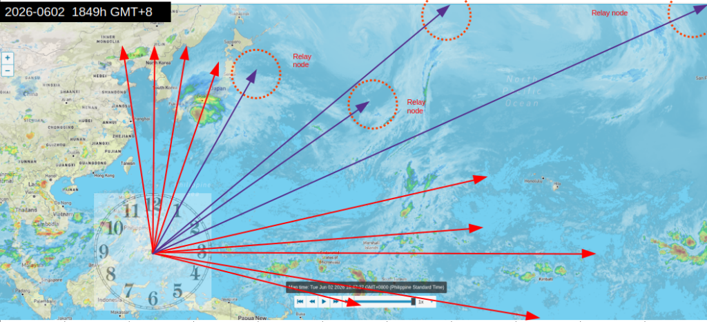
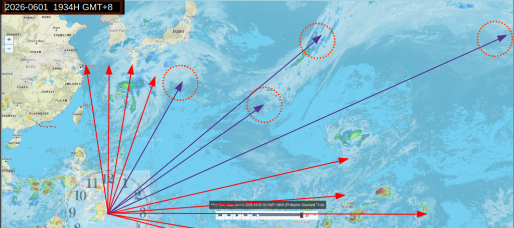
Time for another snapshot, 2026-0601 1934H GMT+8
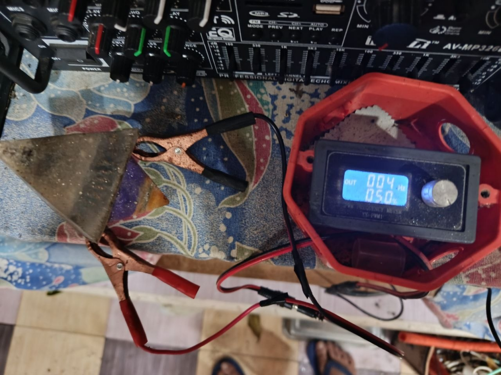
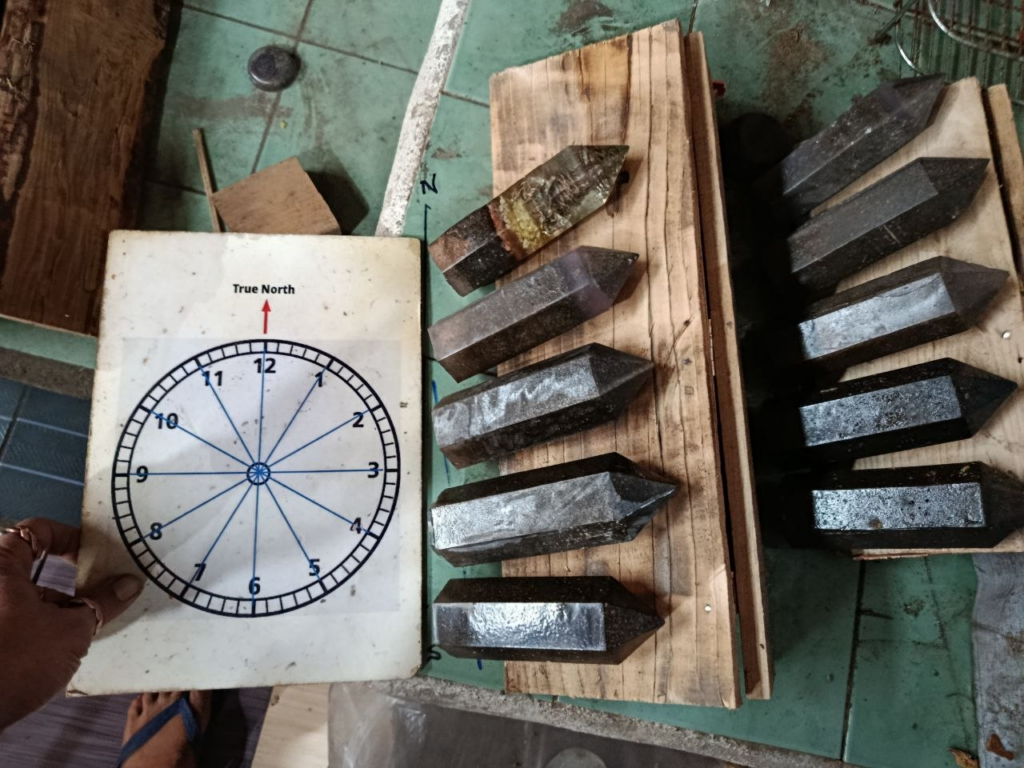
And for the first time, we are testing a small orgonite pyramid, embedded with tensors (we are talking astronomical Bovis units),
The tensors have terminals sticking out of the orgonite pyramid which is then connected to a PWM frequency generator (up to 150 khz), powered by a 15V DC power adapter.
We’ve had this device for a long time now, but we haven’t really used it for weather defense – that’s about to change. We set the frequency to 4hz (theta brainwave frequency).
Here’s the weather snaposhot at the time we began testing. We aimed for the eye of the system (between 12:00 and 1:00).
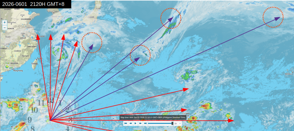
2026-0601 2120H GMT+8
We will take another snapshot by midnight.
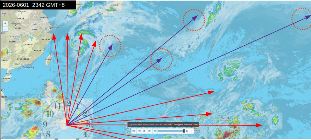
And for the last snapshot of the day – 06026 2342H GMT+8
The adjoining area east of Taiwan appears to be “cleared”. We are keeping the devices pointed in the direction of Taiwan – someone there needs to enjoy their vacation in Taiwan.
I have made adjustments for Japan, and am calling it a day. Hang in there Japan, help is on the way 😇.
Tomorrow is another day – and another snapshot. Am off to the “other side”, I’ll see all of you there.
Here is the latest forecast from Brian aka Mr Weatherman Asia. In his forecast, Jangmi, also Domeng, will become a Tropical Storm and then a Typhoon. When this could impact Japan, especially Okinawa!
Brian further states “this typhoon or tropical storm uh whatever it ends up being is not coming to the Philippines. “
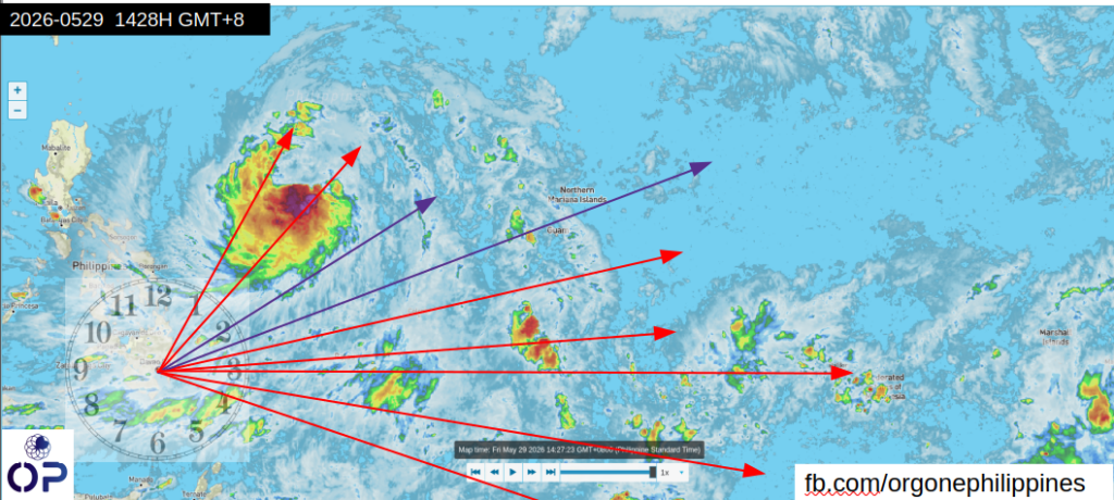
Alrightey – here goes the latest receipts este snapshots,
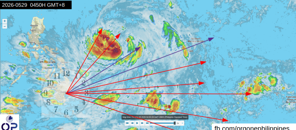
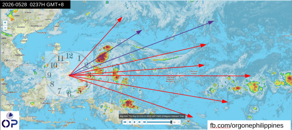
This is early morning, 05/28/26 0237H GMT+8
Note that the system is contained within the 1:30 to 2:30 band.
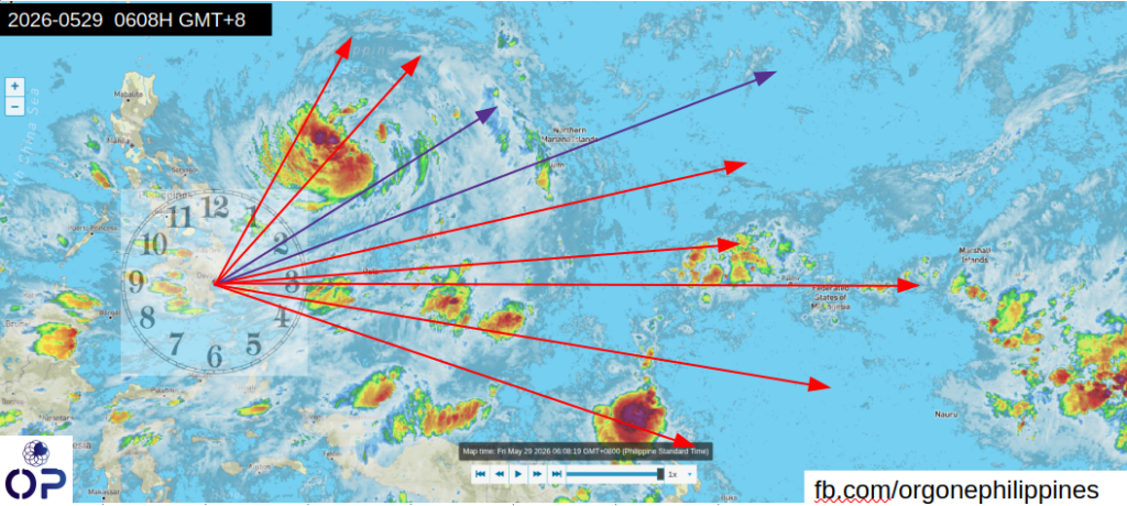
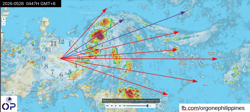
By dawn, 05/28/26 0447H GMT+8 – this is what it looked like.
The system is still contained within the 1:30 to 2:30 band. What that tells us is we now have a situation we call the ” meat grinder”. The system attempts to move forward but is stuck within the “grinder”
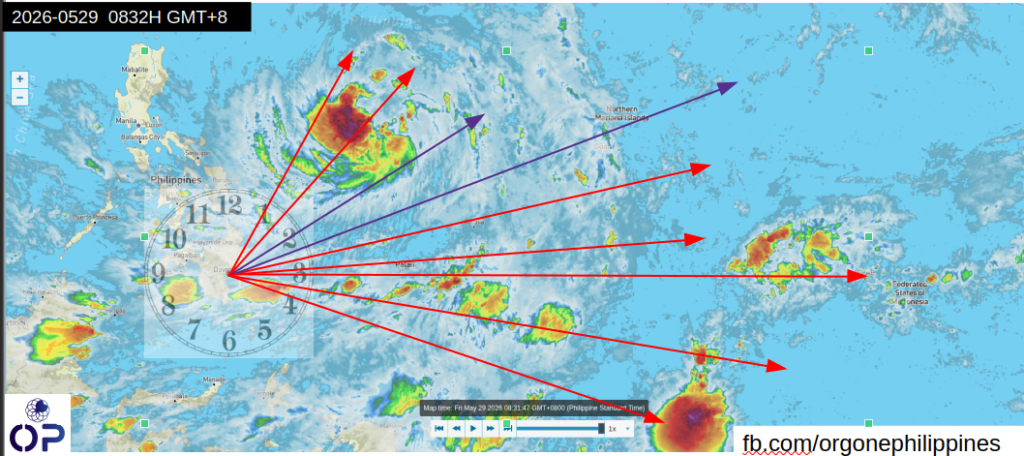
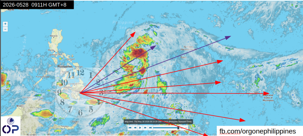
By mid morning 05/28/26 0911H GMT+8, here’s the snapshot. Notice the streak of moisture or “feeder” at the 2:30 position – this is feeding the system.
The system is still stuck in the “grinder” at the 1:30-2:30 band.
We have made adjustments and putting in more resources (tower array / “shredder|) towards the “grinder”.
Till the next update at noon.
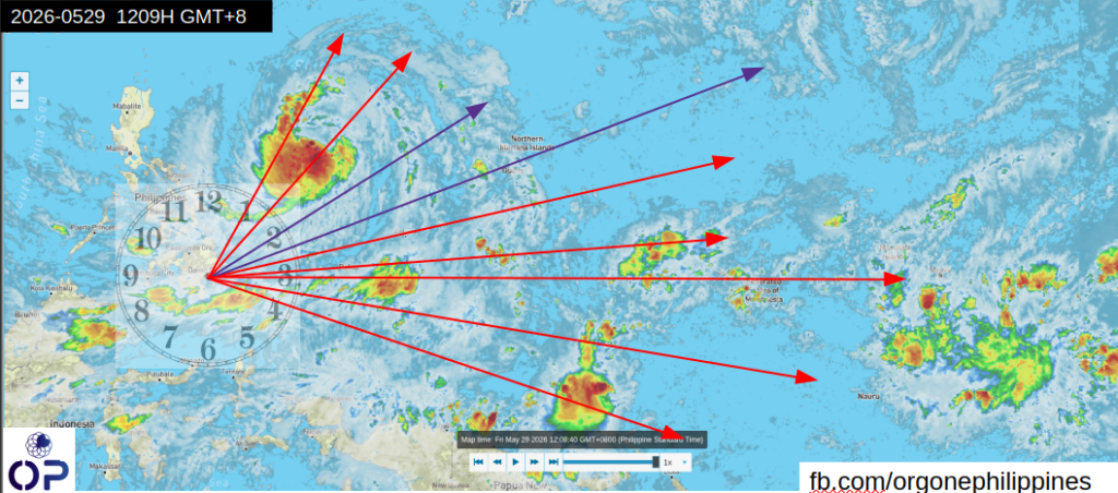
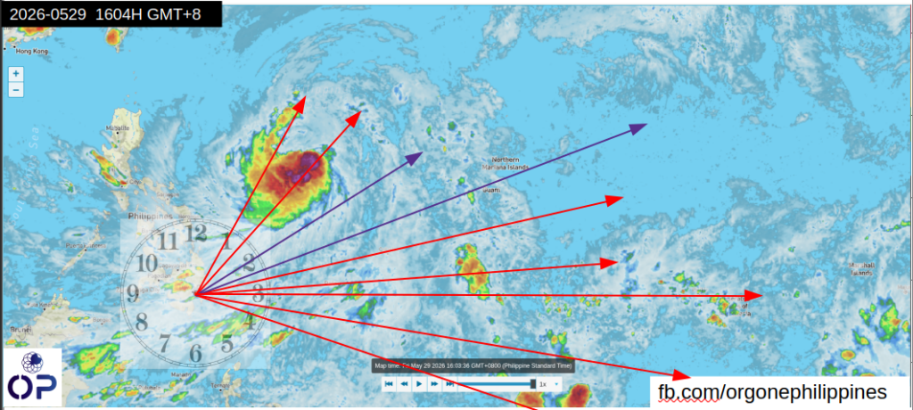
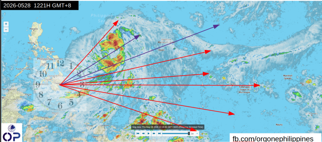
As of noontime 05/28/26 1221H GMT+8
The containment zone / “grinder” holds the system in position. The southeast quadrant from 3:00-4:00 is “cleared”.
The hole in the 2:00 position is a sginature of the pyramids.The thinning bands of green is a signature of the “shredders” and sky guardians.
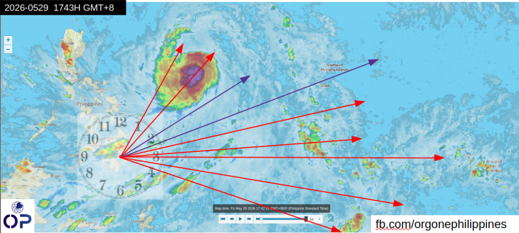
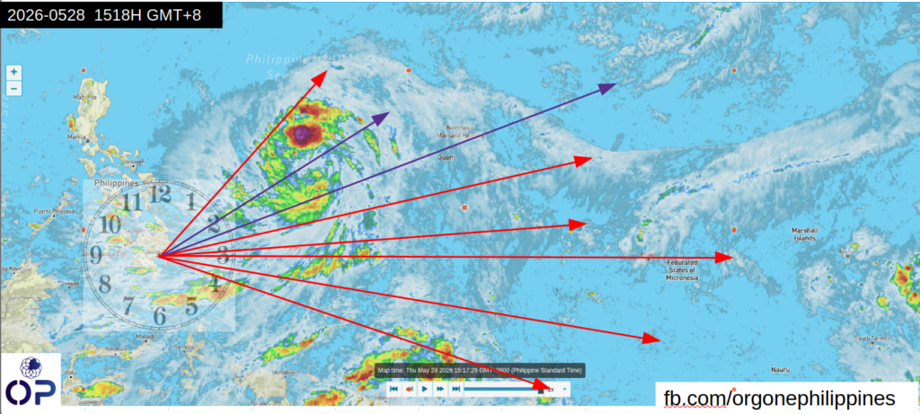
By mid afternoon of 05/28/26 1518H GMT+8, here’s what it looked like.The lower Northeast band (between 2:00 and 3:00) is thinning out as the system is trying to work itself out of the “grinder” between 1:30 an.d 2:00.
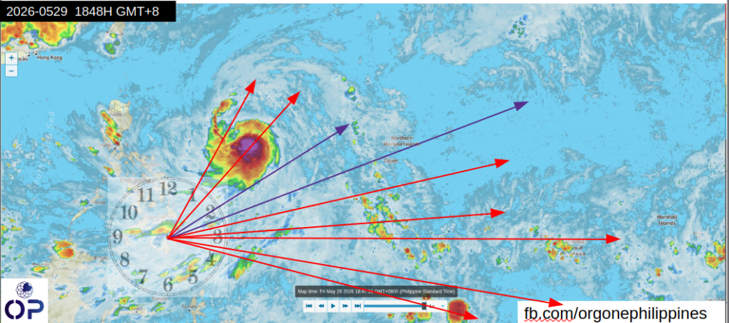
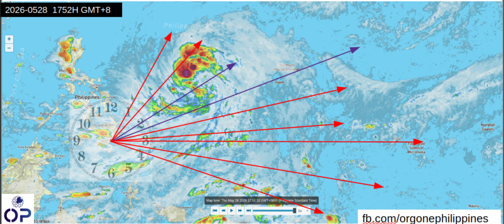
By dusk, 08/28/26 1752H GMT+8, here’s the snapshot.
08/28/26 1752H GMT+8
Under normal circumstances this will have been a Cat5 typhoon by now, riding roughshod over the Philippines.
And the cycle begins again:
The news will be flooding with fear porn. DOST-PAGASA and NDDRMC will be hogging the news.
Massive evacuations, floods and landslides as the system hits landfall.
Grandstanding politicans looking for the nearest photo op to endear themselves to the public
Requests for more funding of flood control projects and rehabilitation.
Investigations into the fraud runing into billions of pesos accompanying the flood control projects.
Nobody goes to jail
Filipinos have to keep shelling out their hard earned income for “flood control projects” to nowhere.
Meanwhile, here we are, a voice in the wilderness that says – the best way to control floods short of stopping the operation of ionospheric heaters aka HAARP – is to prevent the man-made storms which cause the floods.
Can you imagine how much billions of pesos can be saved and used on building more valuable stuff??? Or for a fraction of those billion pesos, I can build a national weather defense network!!!
This reminds me of the broken window fallacy which permeates all levels of government all the way to the highest levels of the country’s leadership.
The broken window fallacy is an economic concept introduced by Frédéric Bastiat in 1850, which argues that destruction does not create net economic wealth. The parable illustrates that while repairing a broken window generates visible income for the glazier (that which is seen), it ignores the opportunity cost of what the owner could have purchased otherwise (that which is not seen).
Common Misapplications: The fallacy is often used to debunk arguments that natural disasters, war, or government stimulus through destruction-based spending benefits the overall economy. .
Misallocation of Resources: Spending money on repairs is a maintenance cost, not new production, diverting funds from productive investments like new inventory or savings.
Net Loss to Society: Destruction results in a net loss because the economy loses the value of the destroyed item without gaining new wealth, only shifting existing resources.
The Karens of course, accuse us of pseudo-science and conspiracy theorists, to which we say.. who is underwater and who is on dry ground? Obviously we are on dry ground while the Karens are underwater! How has your “science” actually helped you? You feel good that there is a forecast? Seriously?
I loved what Brian said – “whatever it ends up being is not coming to the Philippines“. Exactamente.
Today’s forecast is from Mr Weatherman Asia – Brian does an excellent job of the weather status and how it could turn out.
Typhoon Threat! In this video, soon-to-be Tropical Storm Jangmi, Tropical Storm Domeng, will strengthen in the Philippine Sea. See how it could become a Typhoon as it approaches Japan, and what this means for the Philippines, Palau, Yap, Guam, and Taiwan!
Now, the perennial optimist that I am, I noted the keywords “soon-to-be Tropical Storm Jangmi, Tropical Storm Domeng”.
I read those keywords as “Not yet a storm, not yet a typhoon” .
We have made the adjustments in bearing of the orgonite devices.
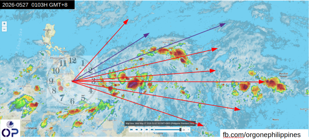
Here’s the earliest snapshot , 05/27/26 0103h GMT+8
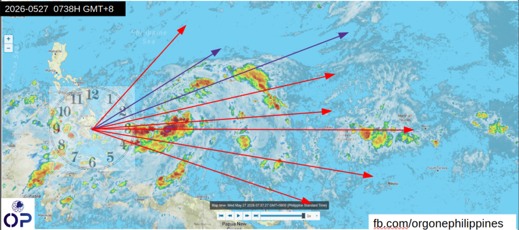
By morning, 05/27/26 0738H GMT+8 , another snapshot was taken.
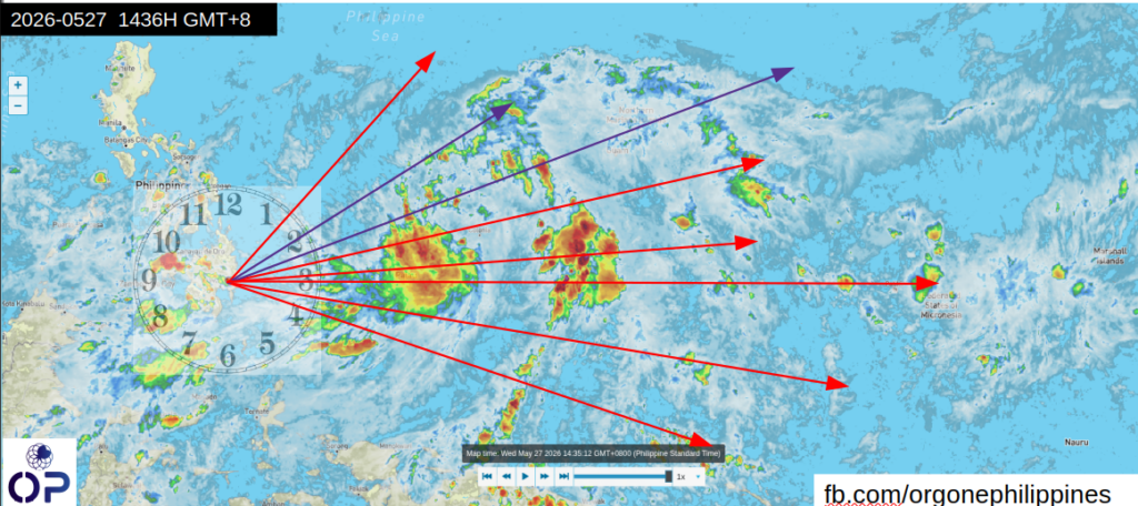
By afternoon of 05/27/26 1443H GMT+8, here’s how it looked.
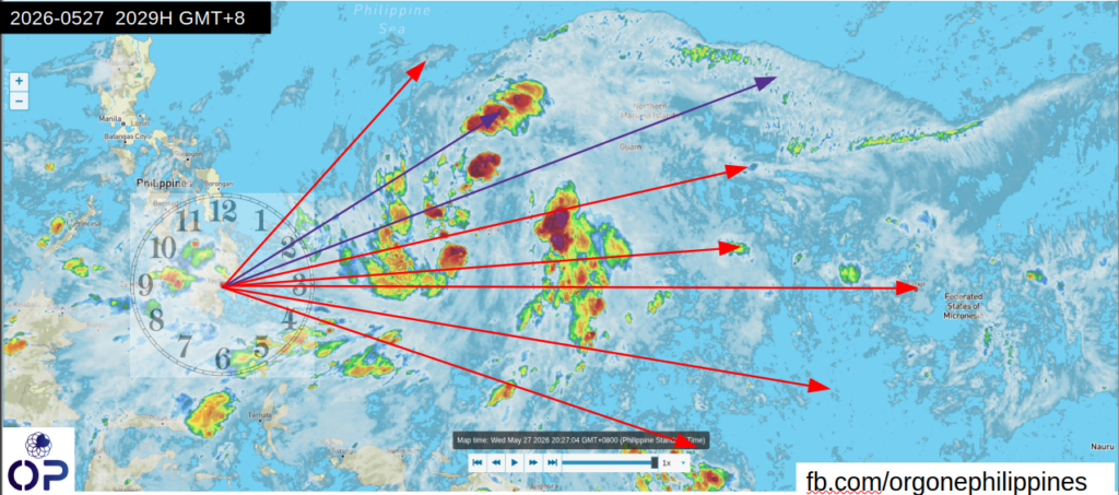
Here’s the snapshot by the evening, 05/27/26 2029H GMT+8.
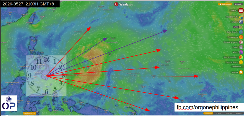
We took another snapshot on Windy – 05/27/26 2103H GMT+8 . A vortex has been identified straddling the 2:00 to 3:00 position.
We have made adjustments to focus on the vortex – aka “the eye” of the storm.
Orgonite towers are placed to cover the northeast quadrant (1:30 – 3:00) .
Orgonite toers / Urth pipes / Shredders spaced evenly to cover 1:30 to 3:00
We will observe the results by midnight (you will understand why we call a group of towers as “shredders”)..
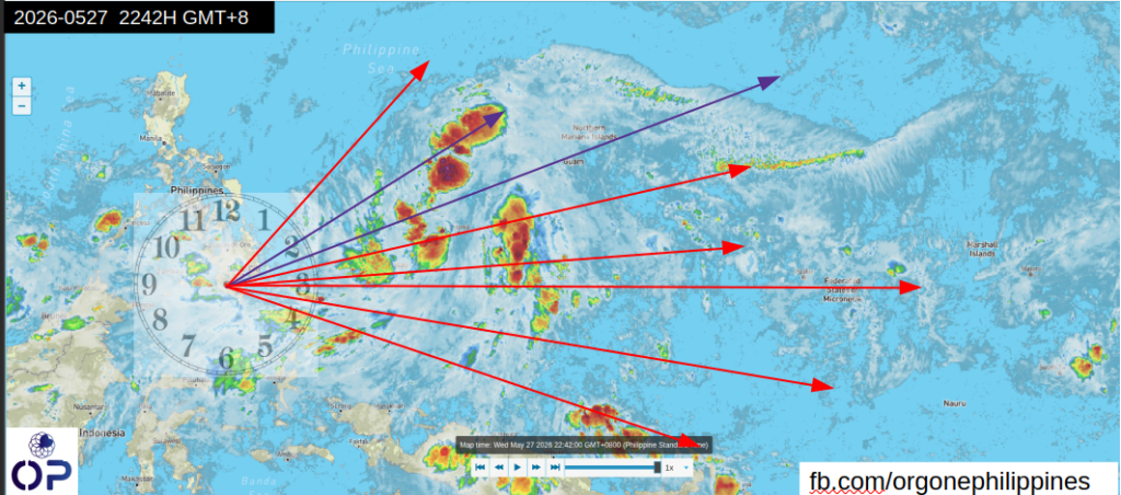
Took another snapshot on 05/27/26 2242H GMT+8
Note that the southeast quadrant is thinning out.
Need Help? Chat with us
Orgone Philippines
Typically replies within a day.
Hello, Welcome to the Orgone Philippines site. Please click below button for chatting me through messenger.